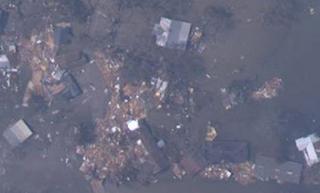
The National Oceanic and Atmospheric Administration has released high-resolution satellite photos of coastal Louisiana and Texas taken after Hurricane Rita's passage. The photos are from Sept. 25-26. Image sizes are between 2-3 megabytes and may take some time to download over a slow Internet connection.
Each pixel in the images resolves to about 1.2 feet - resolution high enough to clearly see vehicles, small houses, boats and landscape features.
Here are direct links to images from:
On Tuesday, the NOAA released further images of inland Cameron, west Calcasieu on the Texas border, south Calcasieu on the Cameron border, and southeast Texas, including:
Garrett Guillotte
Staff writer


No comments:
Post a Comment