Tuesday, September 25

Tropical Depression 13

Storm headed for Mexico

As expected, the slow-moving system in the southwest Gulf of Mexico has become a tropical depression.

The National Hurricane Center said the depression could become a tropical storm Wednesday.

Computer models (shown below) either show little movement or a westward track into Mexico over the next several days.

New System

Storm brewing in the Gulf of Mexico?

The National Hurricane Center is investigating another potential tropical system in the Gulf. Here's the latest advisory:

1. SATELLITE IMAGES INDICATE THAT A TROPICAL DEPRESSION COULD BE FORMING IN THE SOUTHWESTERN GULF OF MEXICO ABOUT 180 MILES EAST OF TAMPICO MEXICO. AN AIR FORCE RECONNAISSANCE PLANE IS SCHEDULED TO INVESTIGATE THE AREA THIS AFTERNOON. THIS SYSTEM IS EXPECTED TO MOVE LITTLE DURING THE NEXT 24 HOURS.

Friday, September 21

Tropical Storm 10

Storm not a threat to SWLA

It looks like the subtropical system in the Gulf of Mexico will affect areas well east of Southwest Louisiana.

At 1 p.m., the depression had maximum sustained winds of about 35 mph, according to the National Hurricane Center.

A tropical storm warning has been issued from Apalachicola, Fla., west to the mouth of the Mississippi River.


Thursday, September 20

Thursday night update

Storm could become tropical system Friday

The National Hurricane Center in its 9:30 p.m. advisory says that the low-pressure system in the eastern Gulf of Mexico could become a tropical depression or storm by Friday.

Based on the latest model runs, this system appears to be heading well east of Southwest Louisiana. However, we'll know more Friday.

Here's the full advisory:

THE LOW PRESSURE AREA IN THE GULF OF MEXICO HAS BEEN MEANDERING DURING THE PAST FEW HOURS AND IS NOW LOCATED ABOUT 115 MILES WEST OF TAMPA FLORIDA. THERE HAS BEEN NO SIGNIFICANT CHANGE IN ORGANIZATION THIS EVENING BUT BANDS OF HEAVY SQUALLS ARE FORMING TO THE NORTH OF THE CENTER ... AND ARE ALREADY AFFECTING COASTAL SECTIONS OF THE FLORIDA PANHANDLE. ENVIRONMENTAL CONDITIONS ARE FAVORABLE FOR THIS SYSTEM TO BECOME A SUBTROPICAL OR TROPICAL CYCLONE AT ANY TIME DURING THE NEXT 24 HOURS AS THE LOW MOVES SLOWLY TOWARD THE WEST-NORTHWEST. ALL INTERESTS ALONG THE NORTHERN GULF COAST SHOULD CLOSELY MONITOR THE PROGRESS OF THIS SYSTEM ... AND TROPICAL STORM WATCHES AND WARNINGS COULD BE PROMPTLY REQUIRED FOR PORTIONS OF THIS AREA ON FRIDAY.


3 p.m. update


Storm still disorganized

The National Hurricane Center just issued this advisory on the storm system in the Gulf of Mexico:

A RECONNAISSANCE AIRCRAFT INVESTIGATING THE AREA OF LOW PRESSURE IN THE EASTERN GULF OF MEXICO FOUND A BROAD CIRCULATION CENTERED ABOUT 115 MILES WEST-SOUTHWEST OF ST. PETERSBURG FLORIDA. THE AIRCRAFT WILL CONTINUE TO INVESTIGATE THE LOW THIS AFTERNOON...BUT THERE ARE NO INDICATIONS YET THAT THE LOW HAS BEGUN TO ACQUIRE TROPICAL CHARACTERISTICS. THUNDERSTORM ACTIVITY WITH THIS SYSTEM REMAINS LIMITED AND DISORGANIZED. HOWEVER...THIS SYSTEM HAS THE POTENTIAL TO BECOME A SUBTROPICAL OR TROPICAL CYCLONE OVER THE NEXT DAY OR SO AS IT MOVES WEST-NORTHWESTWARD OVER THE WARM WATERS OF THE GULF OF MEXICO. ALL INTERESTS ALONG THE NORTHERN GULF COAST SHOULD MONITOR THE PROGRESS OF THIS SYSTEM.

Watching the storm

SWLA officials keeping close eye on storm

The latest computer model runs (below) predict the system will make landfall as a weak tropical storm anywhere from western Florida to western Louisiana.

Local emergency officials have said they will meet today if the system develops. In the meantime, they are watching and waiting.

Clifton Hebert, director of the Cameron Parish Office Emergency Preparedness, said coastal residents should be sure everything is in place in case the system develops.

"They should make sure all of their personal effects are in order in the event further action is necessary," he said. "Keep an eye on the system, follow the news and review evacuation plans just in case."

"The latest information we have gotten said it was too soon to tell if it was going to develop into anything or not," said Dick Gremillion, Calcasieu Parish's director of emergency preparedness. "We could find out (today) that it is going to develop into a tropical storm, or we could find out that it has dissipated."

Thursday morning update

Disorganized System in Gulf

Here's the National Hurricane Center's latest advisory on the low-pressure system making its way into the Gulf of Mexico.

SURFACE OBSERVATIONS INDICATE THAT A WEAK LOW PRESSURE AREA HAS FORMED IN THE EASTERN GULF OF MEXICO IN ASSOCIATION WITH AN UPPER-LEVEL LOW. SHOWER ACTIVITY WITH THIS NON-TROPICAL SYSTEM REMAINS LIMITED AND DISORGANIZED. HOWEVER...THIS SYSTEM HAS THE POTENTIAL TO ACQUIRE SUBTROPICAL CHARACTERISTICS LATER TODAY OR TOMORROW AS IT MOVES WEST-NORTHWESTWARD OVER THE WARM WATERS OF THE GULF OF MEXICO. AN AIR FORCE RESERVE UNIT RECONNAISSANCE AIRCRAFT IS SCHEDULED TO MONITOR THE SYSTEM THIS AFTERNOON. ALL INTERESTS ALONG THE NORTHERN GULF COAST SHOULD MONITOR THE PROGRESS OF THIS SYSTEM.

Wednesday, September 19

Gulf System Update

Models shift

The latest computer model runs for Invest 93, the low pressure system off the east coast of Florida, have for the most part shifted to the east.

The SHIPS model, which predicts intensity, has dropped its maximum wind estimate for the system dramatically. The model is now predicting the system to peak at 40 mph about 48 hours from now.

Gulf Activity

Tropical Storm could form in two days

The low pressure system off the east coast of Florida is expected to enter the Gulf of Mexico, where it could strengthen into a tropical storm.

Computer models (shown below) have it headed toward the Louisiana or Texas coasts.

Monday, September 17

Weather Service: Watch the Gulf

Low pressure system could develop

A low pressure system currently located off the east coast of Florida coast is expected to enter the Gulf of Mexico during the week and could possibly strengthen into a tropical storm or hurricane that could threaten the Texas and Louisiana coasts over the weekend.

Roger Erickson, meteorologist at the National Weather Service's Lake Charles office, said area residents should begin monitoring the situation.

"We do not know if it will develop into a tropical storm or not, but everyone should be keeping an eye on the weather report now to monitor what is going on," he said.

Friday, September 14

New storm

Ingrid forms in Atlantic

Tropical Storm Ingrid has formed in the Atlantic. The latest model runs (shown below) have the storm drifting slowly to the northwest and strengthening only slightly over the next five days.

It is not expected to threaten the Gulf Coast.

Humberto was rare hybrid system

Two systems converged to create havoc


AMERICAN PRESS

Fast-forming Humberto was a "fairly rare" weather event during which two systems collide and quickly spin up into a hurricane, according to the National Weather Service's Lake Charles office.

Meteorologist John Trares said Humberto wasn't a pure tropical system, but a hybrid of two types of systems colliding — in this case a cold front and a broad low pressure trough in the warm waters of the northwest Gulf of Mexico.

Many times such merging systems don't spin up anything, but this time they did, he said.

Trares said this type of weather event more commonly occurs in October in the Bay of Campeche.

Hurricane Humberto resulted from a "double shot of energy," he said.

The meteorologist said a pure tropical system, such as a Cape Verde hurricane, takes much longer to develop into a hurricane, usually three to four days.

Trares said the highest wind speed recorded at the weather service office at Lake Charles Regional Airport was 41 mph at 4:36 a.m.

Rainfall was recorded at 2.33 inches at the airport, but radar estimates showed that throughout the area rainfall ranged from 3 to 6 inches in isolated areas.

The area already was 11 inches above normal for rainfall before Humberto.

Thursday, September 13

City garbage pickup

The City of Lake Charles' Public Works Department announced updates on its garbage pickup for the remainder of the week.

For individuals unable to place out their garbage today, the city will be picking up Thursday's route again on Saturday.

Friday's trash and garbage schedule will be the normal operation for that day.

All transit routes temporarily suspended Thursday morning due to Hurricane Humberto have been resumed.

Back to work, school

  • The 14th Judicial District Court in Lake Charles will be open today for all court business.
  • All McNeese State University classes will resume as scheduled Friday. All school offices will be open too.
  • Calcasieu Parish schools will be open Friday.

Civic Center shelter draws few

Lake Charles Civic Center director Joe Toups said Thursday there were about 18 to 20 area residents who used the emergency shelter.

The shelter was set up Wednesday inside the Civic Center’s James Sudduth Coliseum. It was closed up by 11 a.m. Thursday.

“Some of the people who showed up were afraid to stay in their FEMA trailers,” Toups said.

He said the group in the shelter consisted of both Lake Charles and Cameron residents.

Cameron schools open Friday

Grand Lake High School and the Cameron Parish School Board’s central office will open Friday.

Hackberry, Johnson Bayou and South Cameron High Schools will reopen as scheduled on Monday.

Friday, Sept. 21 will be a full day of school for all students — to replace academic time lost to this closure and previous ones at Hackberry, Johnson Bayou and South Cameron High Schools, Cameron Parish School Superintendent Stephanie Rodrigue said in a statement.

Crews restoring power across SWLA

High winds from Hurricane Humberto caused power outages Thursday to more than 14,500 customers for four different electric systems in several parishes.

Beauregard Electric Cooperative Inc. saw the largest impact with more than 8,000 of its 38,000 customers in all seven parishes it serves losing power Thursday morning.

The majority of the outages occurred in Southwest Louisiana around Sulphur, DeQuincy, Moss Bluff, Merryville, Singer and Ragley. Crews and contract crews began working immediately to restore power.

As of 5 p.m. Thursday, power had been restored to all but 3,000 of its customers.

Entergy reported that 4,000 customers were without power early Thursday, but said by 1 p.m. it had reduced that number to 1,800. Power is expected to be fully restored to all customers by today, officials said.

The majority of the Entergy outages were in the Toomey-Starks area and Sulphur.

Cleco reported that about 2,500 of its customers primarily in DeQuincy lost electrical power as of 11:30 a.m. It reported at 4 p.m. that there were only about 1,900 customers still without power.

The Jeff Davis Electric Co-op reported just a few power outages caused by the hurricane Thursday in the Johnson Bayou area. However, by the end of the day the power had been restored.

Compiled by American Press staff
Photo by Brad Puckett

Gas lines in Vinton

Brad Puckett / American Press

Texas motorists wait in long gas lines at The Lucky Longhorn in Vinton on Thursday afternoon. Many people from southeast Texas whose homes were without electricity throughout the day crossed the state line to purchase gas and other goods.

Damage in Starks

Brad Puckett / American Press

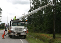
Curtis Johnson of Starks looks over the damage caused by a large pine tree that fell onto his home during Hurricane Humberto. Curtis and his wife Sue were watching the weather on television around 5:30 a.m. Thursday when they heard the tree crash through their bedroom ceiling.

7 a.m. update

Hurricane Humberto forecast track

Humberto now a hurricane

Humberto has strengthened into a Category 1 hurricane with 80 mph winds.

Here is a summary of the latest National Hurricane Center update:

A hurricane warning has been issued from east of High Island, Texas, to Cameron Parish in Louisiana. Hurricane conditions are expected within the warning area within the next few hours.

A tropical storm warning remains in effect in Texas from east of Sargent to High Island, and in Louisiana east of Cameron to Intracoastal City.

Humberto is moving north-northeast near 8 mph.

Its eye is expected to cross the upper Texas coast within the next few hours.

Hurricane force winds extend outward up to 15 miles northeast of the eye. Tropical storm force winds extend outward up to 60 miles.

Rainfall of 5-10 inches are expected along the track of Humberto through eastern Texas as well as western and central Louisiana. Isolated accumulations of 15 inches are possible.

Coastal storm surge flooding of 3 to 4 feet above normal tide levels
can be expected.

Isolated tornadoes are a threat through this morning.

Rainmaker: Southwest La. braces for deluge

BY JEREMY HARPER
AMERICAN PRESS

(12:04 a.m. update)

Calcasieu and Cameron parishes today will likely endure the most rainfall and see the most flooding from Tropical Storm Humberto — a surprise storm that is drenching east Texas and Southwest Louisiana with potentially double-digit inches of rainfall.

It is expected to come ashore between High Island and Sabine Pass, Texas, by 4 a.m. today, according to the National Weather Service.

Its top winds at 10 p.m. were 65 mph and are forecast to reach hurricane strength over a small area near landfall. Tropical force winds extended 60 miles from the center at 10 p.m.

With the storm, heavy rain is expected in much of Southwest Louisiana overnight and throughout today.

Forecasters say 5-10 inches of rain are possible locally, with the heaviest rains coming between midnight and noon.

Tornadoes are a possibility during that period.

With tides expected to be 4-5 feet above normal, some coastal flooding is expected in Cameron Parish. Water on Main Street in Cameron is expected to be up to 18 inches deep.

High tides along the coast are expected to back up waters in area rivers, with the Calcasieu River expected to reach flood stage early this morning. Expected heavy rains may also become a factor in river levels.

“It’s definitely going to be the closest call we’ve had with a tropical system since Hurricane Rita,” Roger Erickson, a meteorologist with the National Weather Service’s Lake Charles office, said late Wednesday.

As a precaution, five Southwest Louisiana parishes have declared a state of emergency.

“It’s an unusual event,” said Dick Gremillion, director of the Calcasieu Parish Office of Emergency Preparedness. “I’m not sure we’ve had one quite like this that changed so rapidly when it was so close to us.”

No evacuations have been ordered, but people in low-lying and flood-prone areas have been urged to take caution.

Cameron and Calcasieu public schools are closed for today, as are Calcasieu school system offices. Hamilton Christian School and Lake Charles Diocese schools in Calcasieu Parish also are closed.

McNeese State University and Sowela Technical Community College will also be closed. Their classes will resume Friday.

The Red Cross opened a shelter Wednesday night in the Lake Charles Civic Center for those in Calcasieu and Cameron parishes who were uncomfortable riding the storm out in their residences. Residents of FEMA trailer parks were offered public transportation to the shelter.

For those area residents needing transportation to the shelter, call the Office of Community Service at 721-4040.

“We just wanted to be proactive and make sure people had a place to go if they weren’t comfortable where they were,” Gremillion said. “We hope it won’t be needed.”

Few people, however, took up the offer for shelter, local Red Cross officials said.

Umberto became the eighth named storm of 2007 at around 1 p.m. Wednesday with maximum sustained winds of 45 mph.

The storm was 150 miles southwest of Cameron when it was upgraded from a tropical depression.

Acadia, Calcasieu, Cameron, Jeff Davis and Vermilion parishes made emergency declarations as precautionary measures.

The system’s rapid intensification and proximity to land left little time for preparation, emergency officials said.

Gremillion’s advice is simple: “Secure yourself as well as you can and just stay home. Stay off the roads. There’s going to be a lot of high water and high wind, potentially.”

Wednesday, September 12

Humberto strengthens

Tropical Storm Humberto is now packing maximum sustained winds of 65 mph, according to the National Hurricane Center's latest update.


No classes at McNeese, Sowela

McNeese State University and Sowela Technical Community College will be closed Thursday.

Some Catholic schools closed Thursday

Diocese of Lake Charles schools in Calcasieu Parish only will be closed on Thursday, the diocese announced tonight.

Cameron, Calcasieu schools closed Thursday

Public schools in Cameron and Calcasieu parishes will be closed Thursday because of Tropical Storm Humberto.

Cameron gave the closure order this afternoon. Calcasieu followed suit minutes ago, with the following announcement:

======

All Calcasieu Parish School System schools will be closed on Thursday, September 13, 2007.

Charlene Chiasson
Public Information and Quality Officer
Calcasieu Parish School System

Sand bags available

Sand bags are available at several Calcasieu Parish locations.

Since the facilities are not manned, parish residents must fill the sand bags themselves with their own shovels.

Bags are available year round at all locations except those specified with an asterisk, which only offer bags during an emergency.

Ward 1 Barn -- 461 Parish Road, Moss Bluff
Ward 2 Barn -- 7085 Hwy 14 East, Hayes
Ward 3 Old Barn -- 2320 Smith Road, Lake Charles
Ward 3 PW Facility -- 5500 B Swift Plant Road, Lake Charles
Ward 4 PW Facility* -- 2915 Post Oak Road, Sulphur
Ward 8 Barn* -- 1726 Parish Barn Road, Iowa
Ward 5 Barn* -- 129 3rd Street, Starks
Ward 6 Barn* -- 1275 Plum Street, DeQuincy
Fire 6 Fire Station* -- 108 Marcentel Road, DeQuincy
Ward 7 Barn* -- 1129 Eddy Street, Vinton
Ward 7 Fire Station* -- 2205 Hwy 388, Vinton (Edgerly)

Red Cross gets ready

A tractor trailer of Red Cross supplies is in place at the Lake Charles Civic Center for people who seek shelter there from Tropical Storm Humberto.

At 8:22 p.m. -- the American Press' third visit tonight -- Denver Kaufman of the Civic Center staff was directing efforts at the coliseum, where Calcasieu Parish employees have parked a Red Cross 18-wheeler at the service entrance.

The supplies are from the Red Cross' Kirkman Street facility. They were trucked across town with a parish rig earlier this evening.

There was no rain, and no people seeking shelter yet, as parish employees cranked the trailer level and placed wood chocks under its tires.

People who want to shelter at the Civic Center are asked to bring their own supplies.

Shelter open at Civic Center

The Red Cross has opened a shelter in the Lake Charles Civic Center for area residents in Calcasieu and Cameron who do not feel comfortable with their current location, emergency officials said.

Anyone in need of transportation to the shelter can contact the Calcasieu Office of Community Service at 721-4040.

OEP: Stay home tonight


Calcasieu Parish Office of Emergency Preparedness Director Dick Gremillion told the American Press this afternoon that his office is encouraging area residents to stay off the roads tonight as Humberto makes landfall.

“About the only thing we can tell people is when you get home, secure yourself as well as you can and just stay home,” Gremillion said. “Stay off the roads. There’s going to be a lot of high water, high wind potentially.”

Cameron Parish schools to close Thursday

Cameron Parish schools will be closed Thursday, Sept. 13, due to the threat of winds and flooding from Tropical Storm Humberto.

The decision to close schools was made after a meeting with parish emergency officials, Superintendent Stephanie Rodrigue said Wednesday afternoon.

“It’s just unsafe driving conditions for our students and our employees,” Rodrigue said.

Humberto could bring heavy rains to SW La.

Tropical Storm Humberto, located about 150 miles southwest of Cameron, could produce up to 15 inches of rain in Texas and parts of Southwest Louisiana, the National Weather Service said.

Local emergency officials are meeting this afternoon to discuss preparations for the storm.


Tropical Storm Humberto forms

With its 1 p.m. advisory, the National Hurricane Center has upgraded Tropical Depression 9 to Tropical Storm Humberto.

Maximum sustained winds are now 45 mph, with higher gusts.

Local storm impacts


According to Roger Erickson, a meteorologist with the National Weather Service's Lake Charles office, the potential area impacts of Tropical Depression 9 include:

Rain: 5 to 10 inches, with 15 inches possible in some areas.

Tides: Coastal tides running 3-4 feet above normal tonight and Thursday.

Winds: Tornado threat mainly in the daytime hours, Wednesday afternoon and Thursday.

"This system is expected to be picked up by a cold front by Friday and lift out of our region," Erickson said in an e-mail. "If the front misses the tropical depression, the above impacts could last longer than just today and Thursday ... could extend into Friday as well."

Tropical Depression organizes in Gulf of Mexico

Tropical storm warning for Cameron

The National Weather Service has issued a tropical storm warning for parts of the Texas and Cameron Parish coasts.

A tropical storm warning means tropical storm conditions are expected within the next 24 hours.

What is now being called Tropical Depression 9 formed this morning in the Gulf of Mexico about 85 miles southwest of Galveston. It has maximum sustained winds of 35 mph.

The mass, which is expected to strengthen, is moving toward the north near 6 mph and its center should make landfall along the Texas coast later today within the warning area between Port O’Connor, Texas, and Cameron, the Hurricane Center said.

No evacuations have been called for Cameron Parish.

Tropical Depression projected path

Monday, September 3

Sunday, September 2